VISIR-2 is a numerical model realised by the CMCC Foundation.
Changelog
All new features and improvements can be found in this section.
v6
-
user-provided shoreline instead of NOAA shoreline
-
weighted means on cumTime (*) for voyage metrics (affected output files:
Solutions*) -
more informative messages added when the provided port is not in the database or the choosen evaluation type is not among the allowed ones
-
to avoid negative or small STW for motorboats, a clipping is introduced (
minSpeed= 0.5 [kn] inSTW_model_switchfunction) -
< | δ* | > in
Solutions*insead of | < δ* > |
(*) impact on previous result is described here
v5
- clearer inline comments in the input namelists
- enhanced GUI (based on streamlit) for port code search
- updated user manual (Docs/Manual)
- bug fix(*) for case of input fields with overlapping timespans
- bug fix(*) relative to marine fields pre-processing in certain costal regions
(*) already published results are unaffected.
v4
- search by sea port code is also possible
- flexible longitude ranges (both in 0-360 and in ±180)
- fixed (*) preproc failure for standalone wind files, see changes in
netCDF_utils.pyand in thenetCDF_pathswitch inedge_Wind.py
(*) published results unaffected as netCDF_path was none
v3
- revision for colorblind-friendly visualization
v2
During the peer-review of the latest manuscript regarding the VISIR model (https://doi.org/10.5194/egusphere-2023-2060-AC2) it became apparent that a cartographic projection was missing. This oversight impacted ship course calculations.
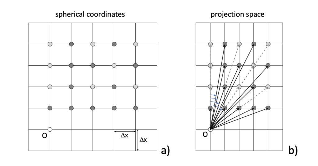
The bug has been addressed by releasing a new version of VISIR-2 (Python) and applying a patch to VISIR-1 (Matlab). It is strongly recommended to download the updates as provided below and re-run previous calculations for accuracy.